
1. Background
Wildfire affects 4,000,000 square kilometers of Earth’s land each year (ESA, Counting wildfires across the globe). Wildfire smoke causes 339,000 premature deaths annually (Johnston FH, et al. 2012. Environmental Health Perspectives).
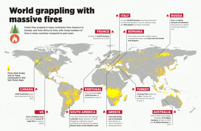
- Canada: 4,091 fires have been reported so far in 2021.
- US: Over 1.8 million acres burned in various large fires in 2021.
- Russia: Over 1.3 million hectares have gone up in flames in July 2021.
- France: An area of 22,307 hectares burned with Bulgaria, Greece, and areas near the border of Romania in 2021.
- South America: 200 fires destroyed over 5.5 million hectares in July 2021. Patagonia, Argentina, moved to Buenos Aires on the Atlantic coast.
- Greece: Fires that started near the highway near Athens on July 31, 2021.
- Turkey: 174 fires broke out in Turkey on July 28 to Aug. 4.
- Australia: Fires in New South Wales burned 2.1 million hectares of land in 2020 and 31 million burned in 2021.
Wildfire impacts
Health risks
- Direct population exposure
- Mental health
- Evacuation-related injuries
- Inhalation of smoke
Ecological impacts
- The carbon sink function of forests
- Intensify global warming
- Reduce biodiversity
- Reduce air quality
Economic impacts
- Direct costs
- Support and logistics
- Restoration and rehabilitation
2. Technical Architecture
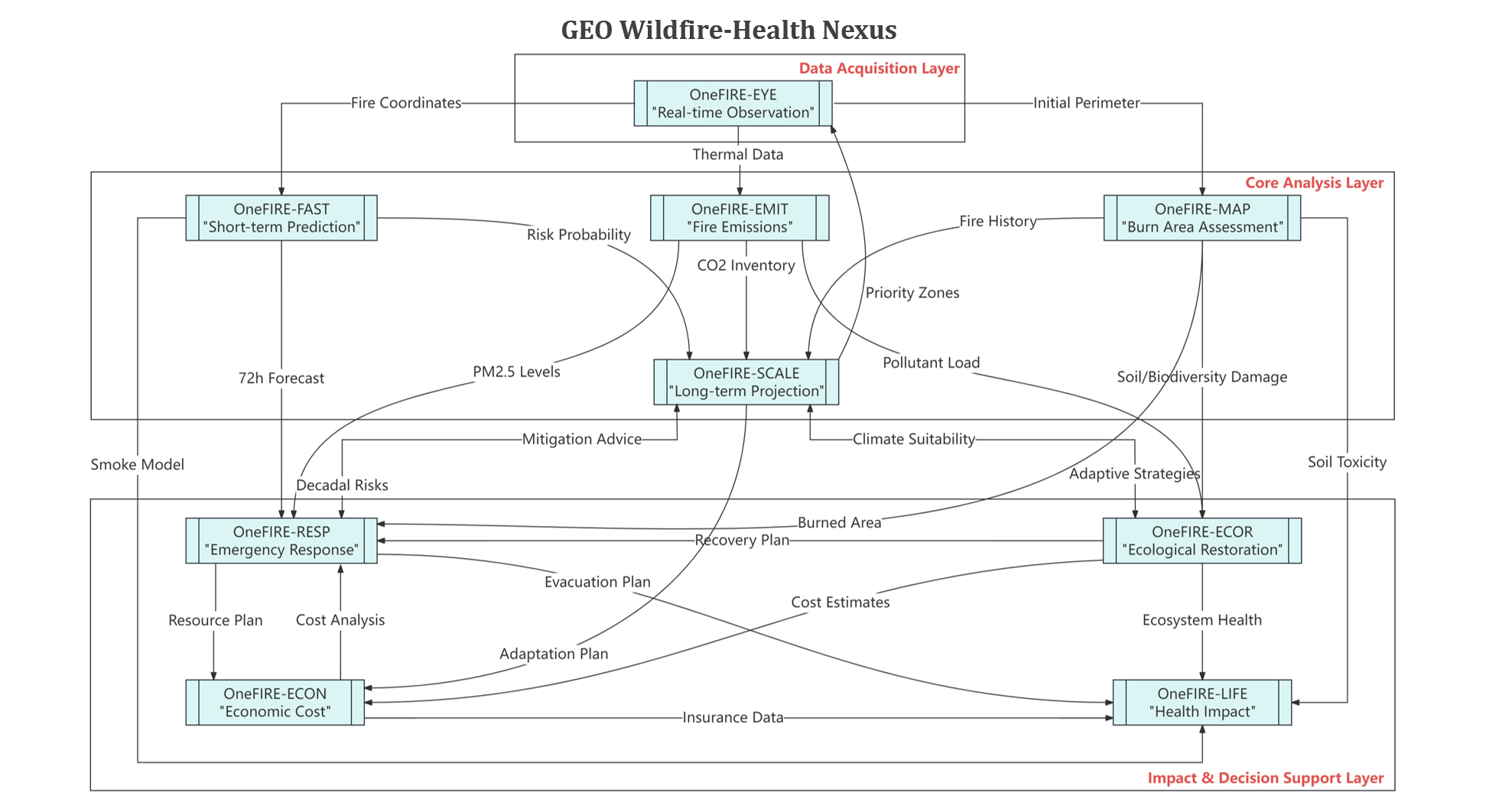
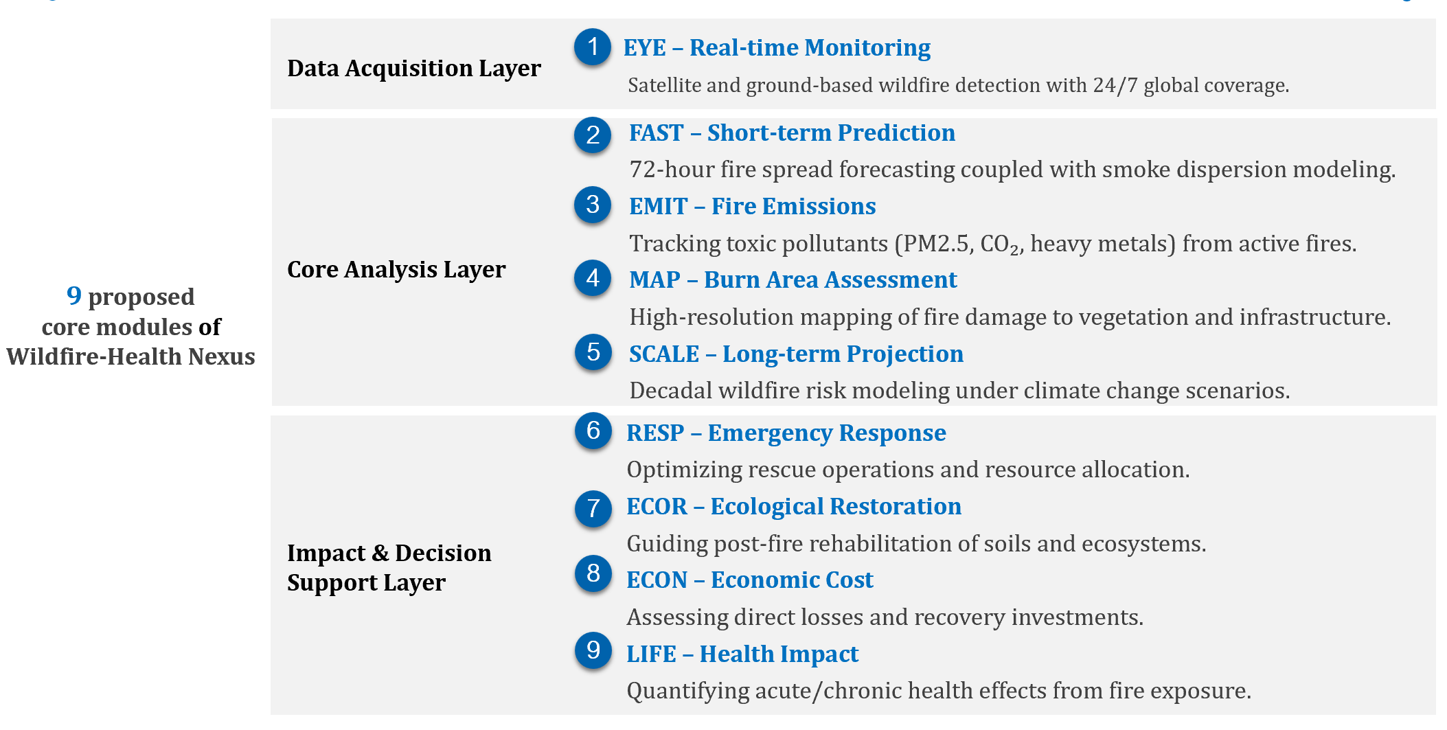
3. Modules and Components
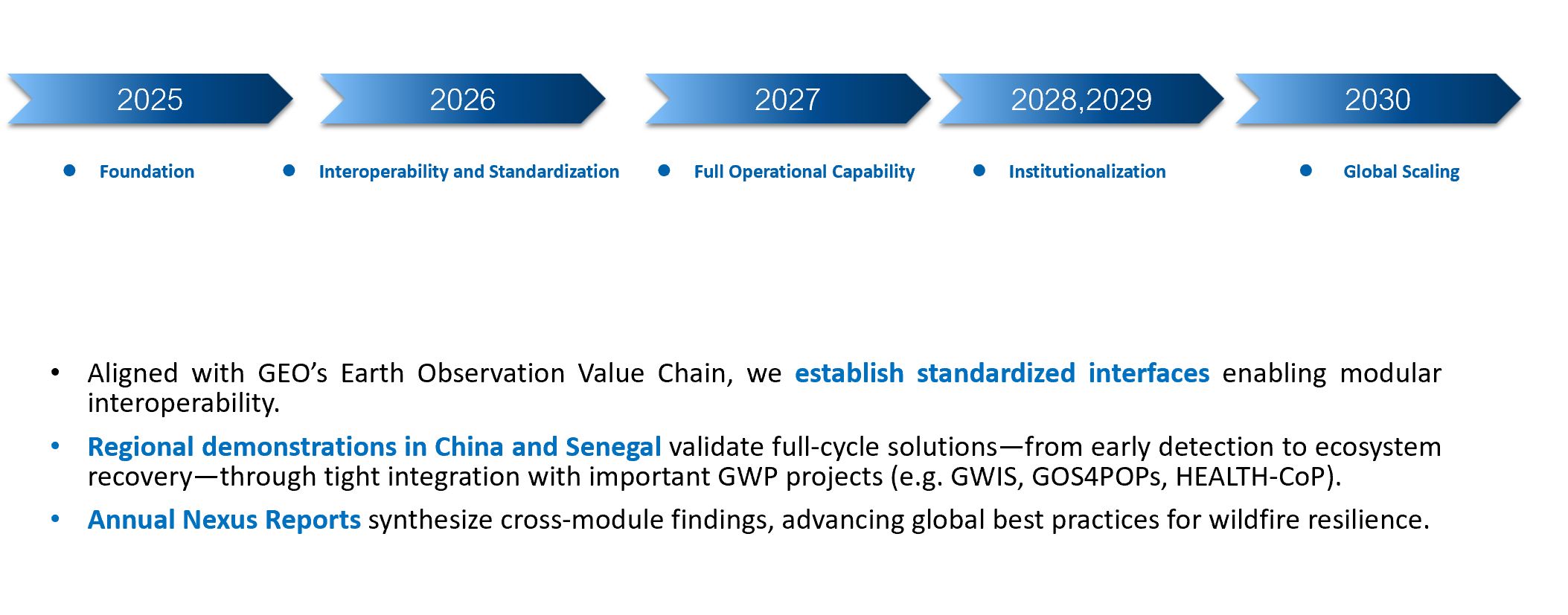
4. Expected Outcomes
5. Founding Members
| Name | Affiliation | Country | Related Expertise | |
|---|---|---|---|---|
| Yuqi Bai | Tsinghua University | China | Wildfire-health impact assessment using Earth observation technologies | yuqibai@tsinghua.edu.cn |
| Amadou Sall | Centre de Suivi Ecologique (CSE) | Senegal | Wildfire monitoring systems using MODIS satellite data to assess and track annual burned areas | amadou.sall@cse.sn |
| Emilio Chuvieco | University of Alcalá | Spain | Satellite-based fire monitoring, development of globally standardized fire datasets (burned area, fire emissions), policy integration for wildfire emissions accounting | emilio.chuvieco@uah.es |
| Fang Li | Institute of Atmospheric Physics, Chinese Academy of Sciences | China | Earth System Models (fire and land surface ecological processes), Global Fire Model Comparison Program | lifang@mail.iap.ac.cn |
| Suju Li | National Disaster Reduction Center of China | China | Wildfire response within satellite emergency response and disaster monitoring | lisujuff@vip.sina.cn |
| Weimin Hou | Hebei University of Science and Technology | China | Remote sensing signal processing and its applications in fire monitoring | hwm@hebust.edu.cn |
| Yufeng Cao | Beijing Forestry University | China | Wildfire monitoring and prediction, climate effects of wildfires, remote sensing data processing for wildfire risk assessment | yfcao@bjfu.edu.cn |
| Wenhui Zhao | Tianjin Normal University | China | Vegetation remote sensing, drought monitoring, and vegetation productivity estimation, disaster risk assessment | wenhuizhao@tjnu.edu.cn |